-
Peñasco Quemado, Sonora, Mexico
 * Refer to the Silverton Metals Corp. (TSX-V: SVTN) website for further information regarding these Mexican assets, content will be removed soon.
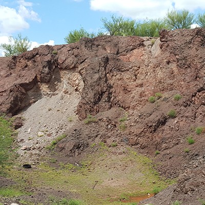
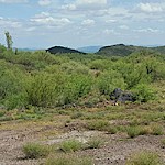
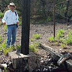
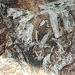
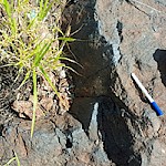
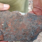
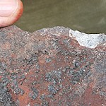
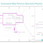
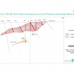
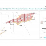
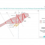
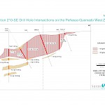
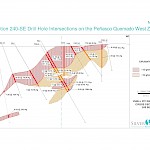
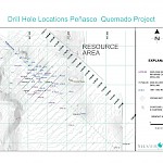
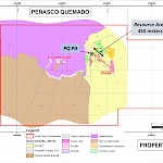
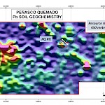
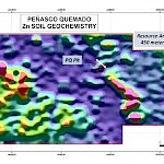
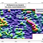
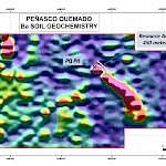
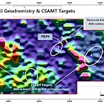
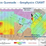
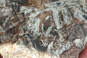
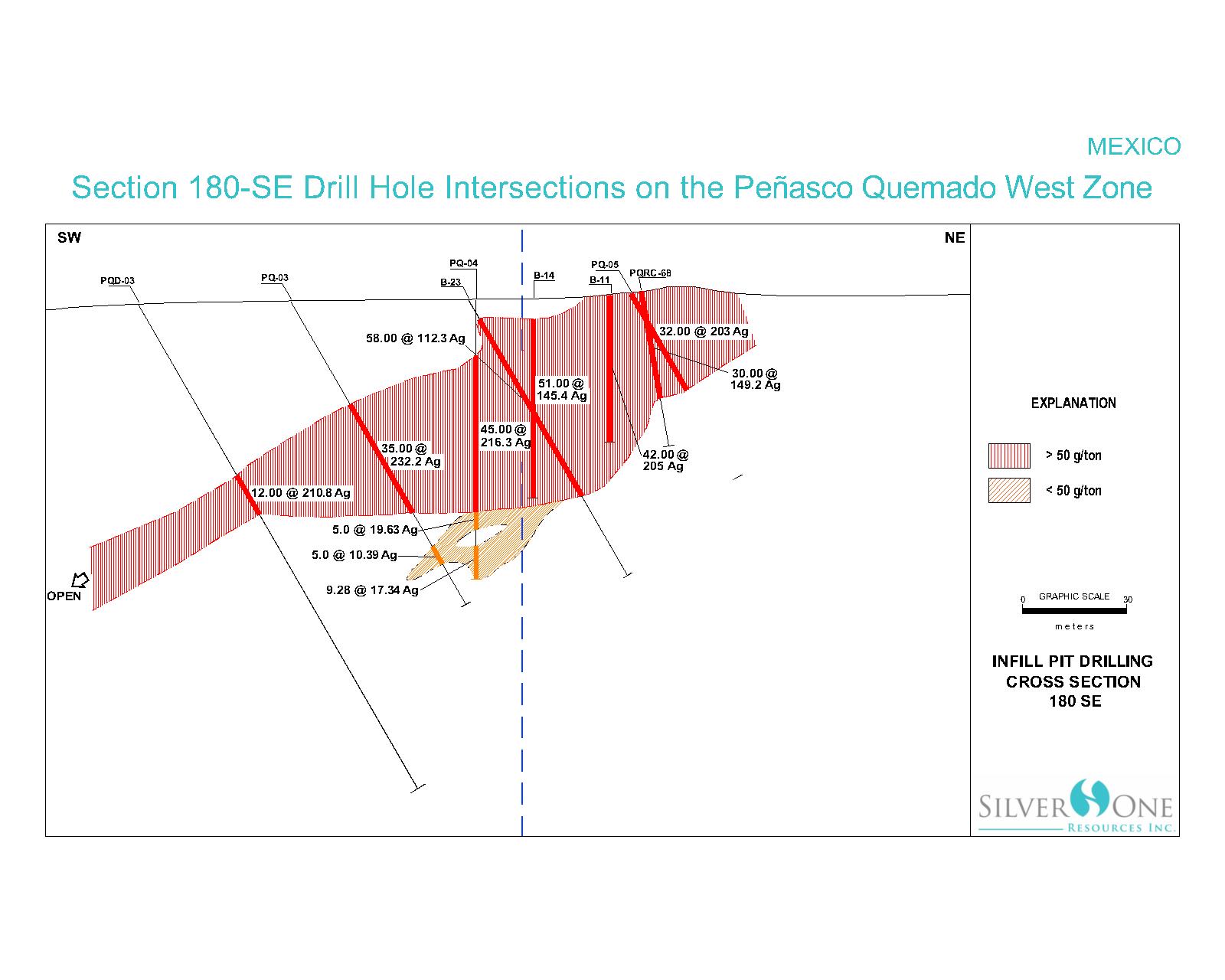
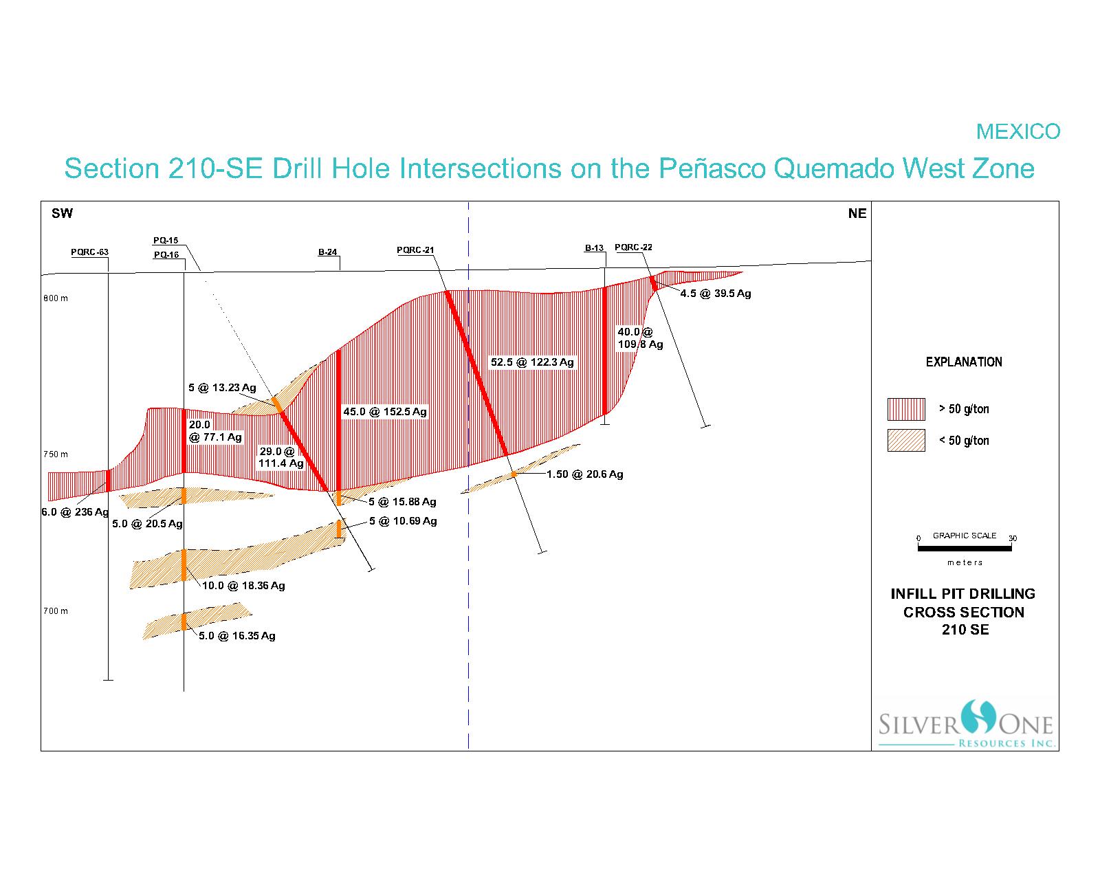
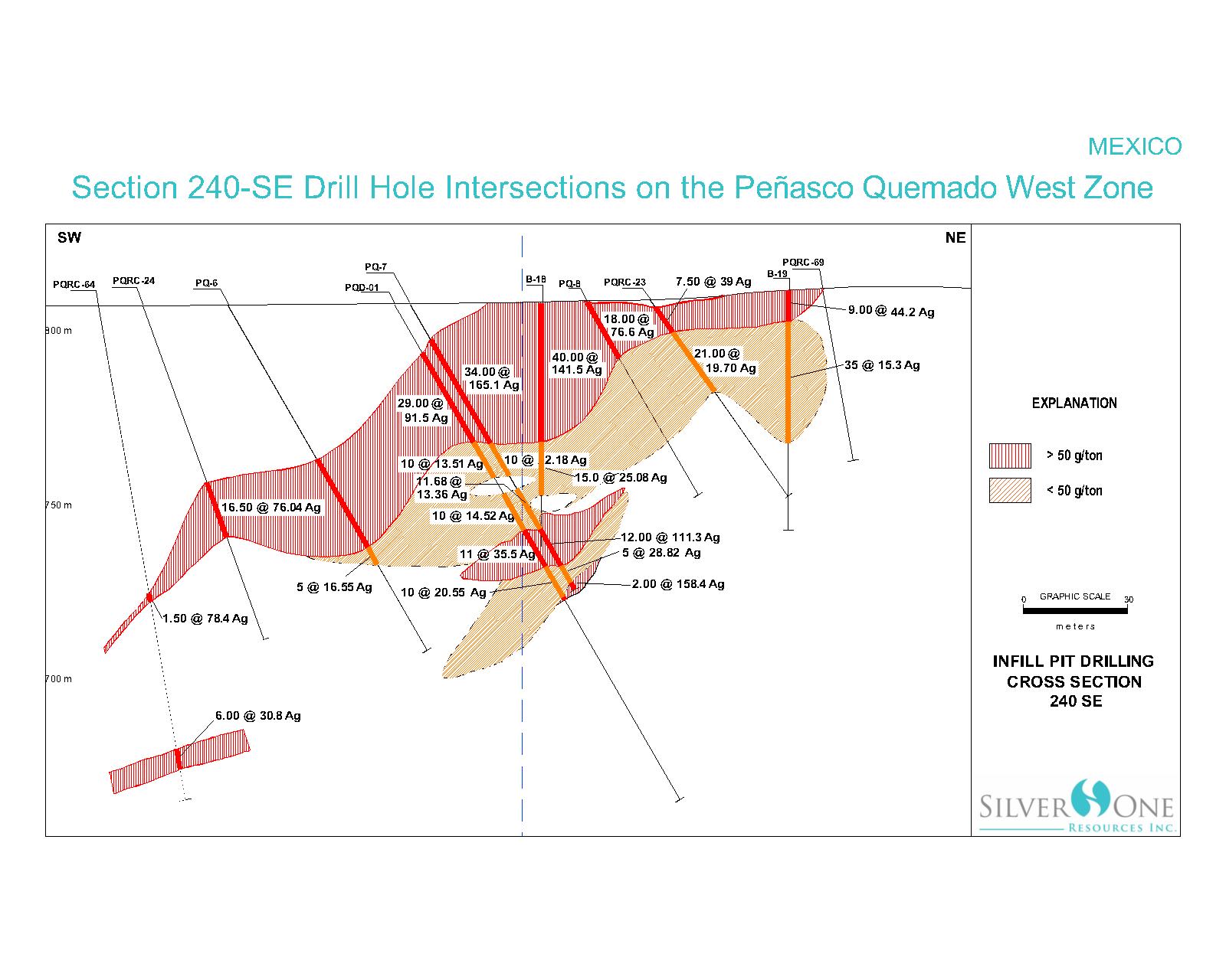
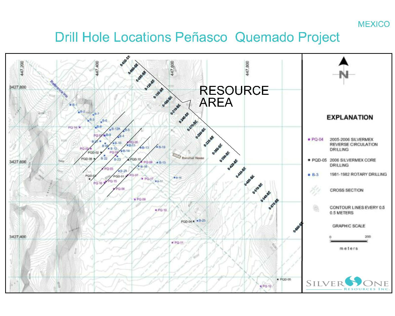
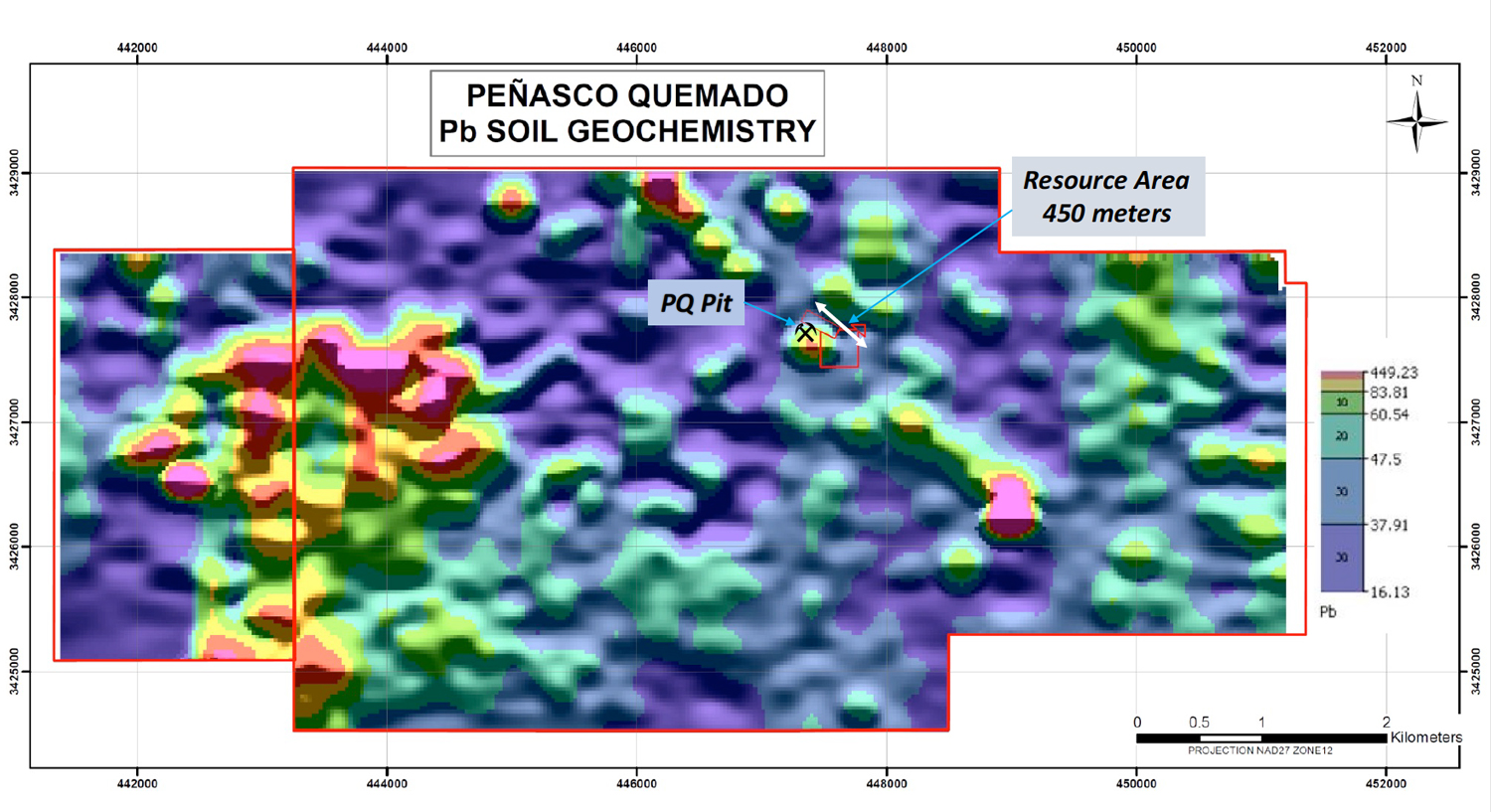
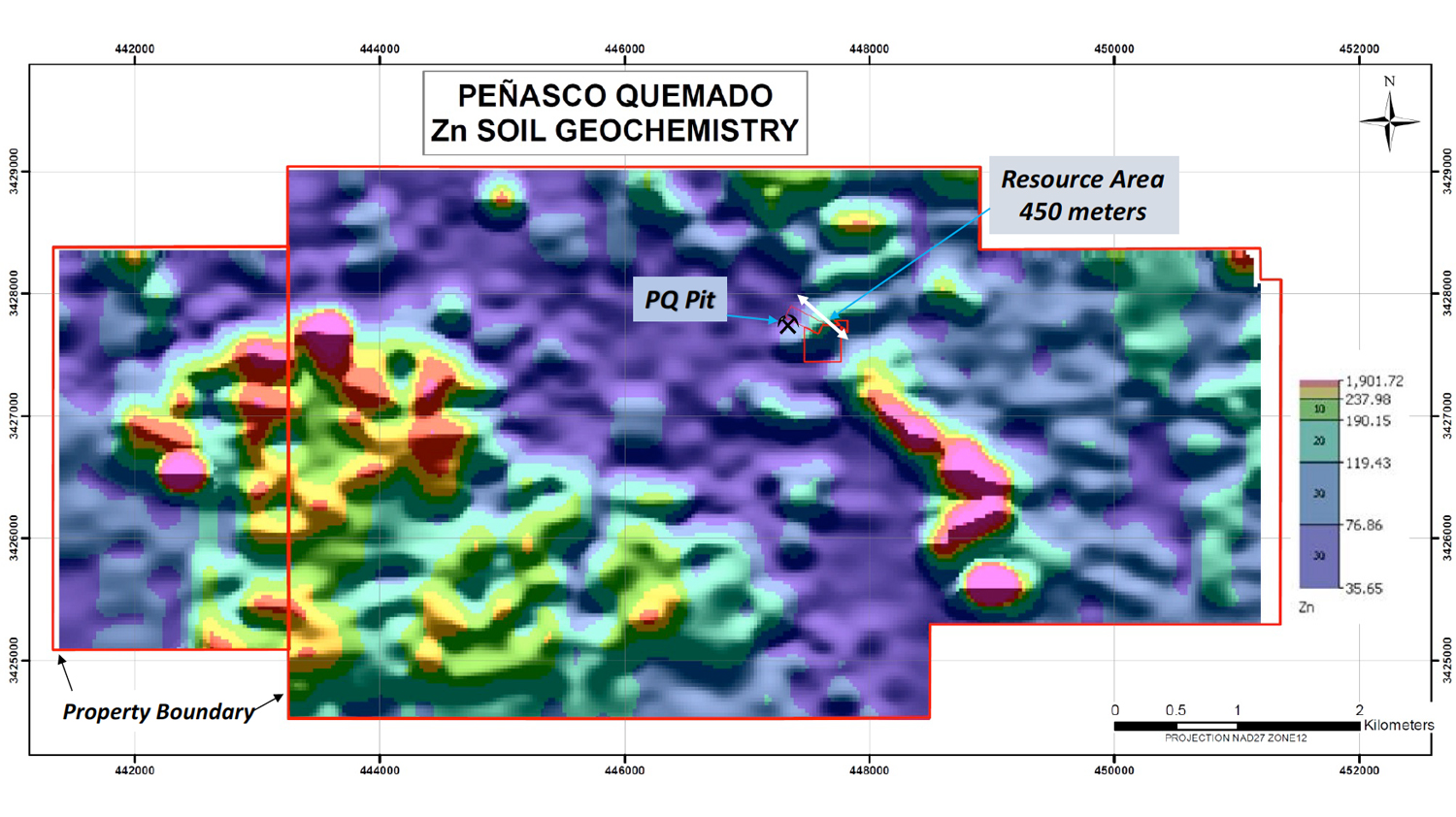
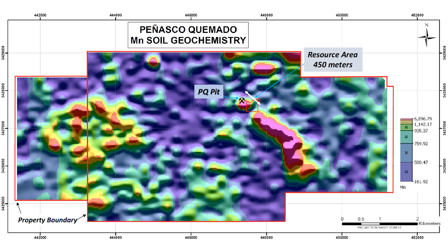
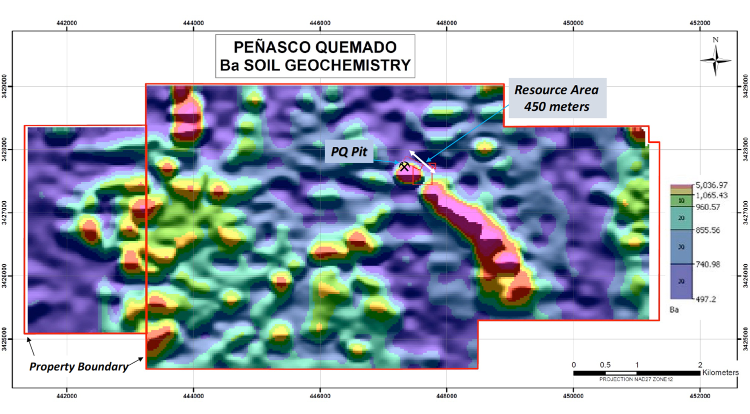
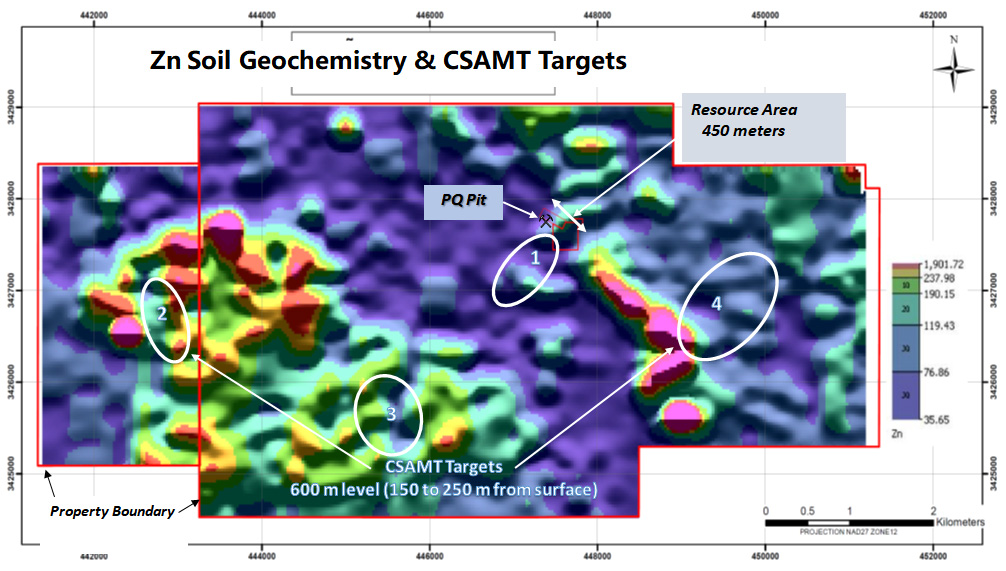
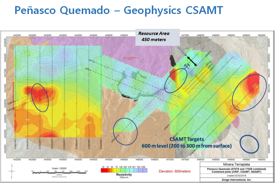
Peñasco Quemado, is located in northern Sonora, 60 km south of the town of Sasabe on the US-Mexican border and comprises 3,746 hectares in seven concessions. A 2006 drilling program outlined a historical measured and indicated resource of 2.57 million tonnes at a grade of 117 g/t Ag for a silver resource of 9.63 million ounces. The silver mineralization is associated with manganese oxides in a near surface shallow westerly dipping zone of polymictic conglomerate in the northern part of the deposit and in stockwork quartz and manganese oxides in a rhyolite dome in the southern part of the deposit. The mineralization has been traced along a 2 km strike length and drilling to date has been relatively shallow, less than 100m deep, mainly focused on the silver-bearing conglomerate. Given the unusual nature of the mineralization, its long strike length with potential extensions, the permeable sedimentary host coupled with the shallow nature of the drilling, it is possible that a larger resource could be developed on the property. If the manganese oxide is an indication of shallower near surface mineralization deposited under oxidized conditions, there remains the possibility that deeper mineralization could be associated with sulfides.
-
Historical Mineral Resource
Resource Category (Underground) Mineral Type Tonnes (Mt) Ag (g/t) Ag (Moz) Measured Oxides 0.12 152 0.60 Indicated Oxides 2.44 115 9.03 Total M + I Oxides 2.57 117 9.63 Inferred Oxides 0.10 41 0.13 ** Silvermex Resources Limited reported in a technical report titled “Updated NI 43-101 Technical Report and Resource Estimate for the Penasco Quemado Silver Property” dated March 9, 2007 (filed on SEDAR on March 16, 2007), prepared by William J. Lewis and James A. McCrea, the above historical mineral resource estimate. The historical mineral resource estimate used “measured mineral resource”, “indicated mineral resource” and “inferred mineral resource”, which are categories set out in NI 43-101. Accordingly, Silver One considers these historical estimates reliable as well as relevant as it represents a target for exploration work by Silver One. The data base for the historical resource estimate consisted of 24 reverse circulation holes from a 1981/82 program, 17 reverse circulation holes from a 2006 program and 8 diamond drill holes from a 2006 drill program. Assay data was available for all 49 of the drill holes and 12 trenches. The mineral resource estimate used a kriging estimation method to establish ore zones with a cut-off grade of 30 g/t Ag and assayÂ’s capped at 700 g/t Ag. Resource blocks were estimated by ordinary kriging with samples within a search radius of 25 meters classified as a measured mineral resource, within 47 meters classified as an indicated mineral resource and within 70 meters classified as an inferred mineral resource. As required by NI 43-101, CIM definitions (August, 2004) were used to classify mineral resources with the classification of each kriged ore block dependent upon the number of penetrating holes. An in-situ block density of 2.50 t/cu meter was assigned the ore blocks. The qualified person has not done sufficient work to classify the historical estimate as a current mineral resource therefore Silver One is treating these historical estimates as relevant but not current mineral resources.
-
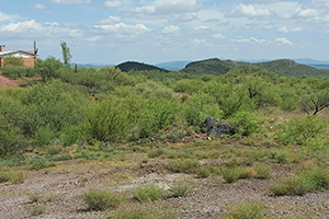
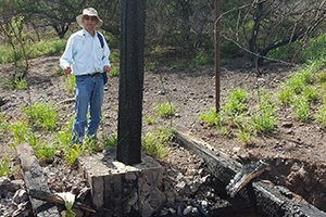
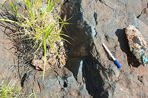
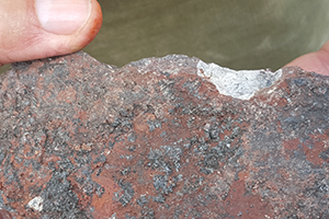
Photos
-
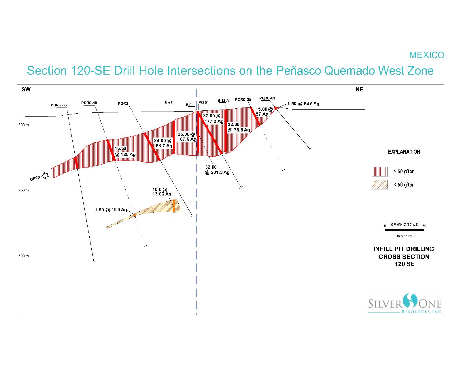
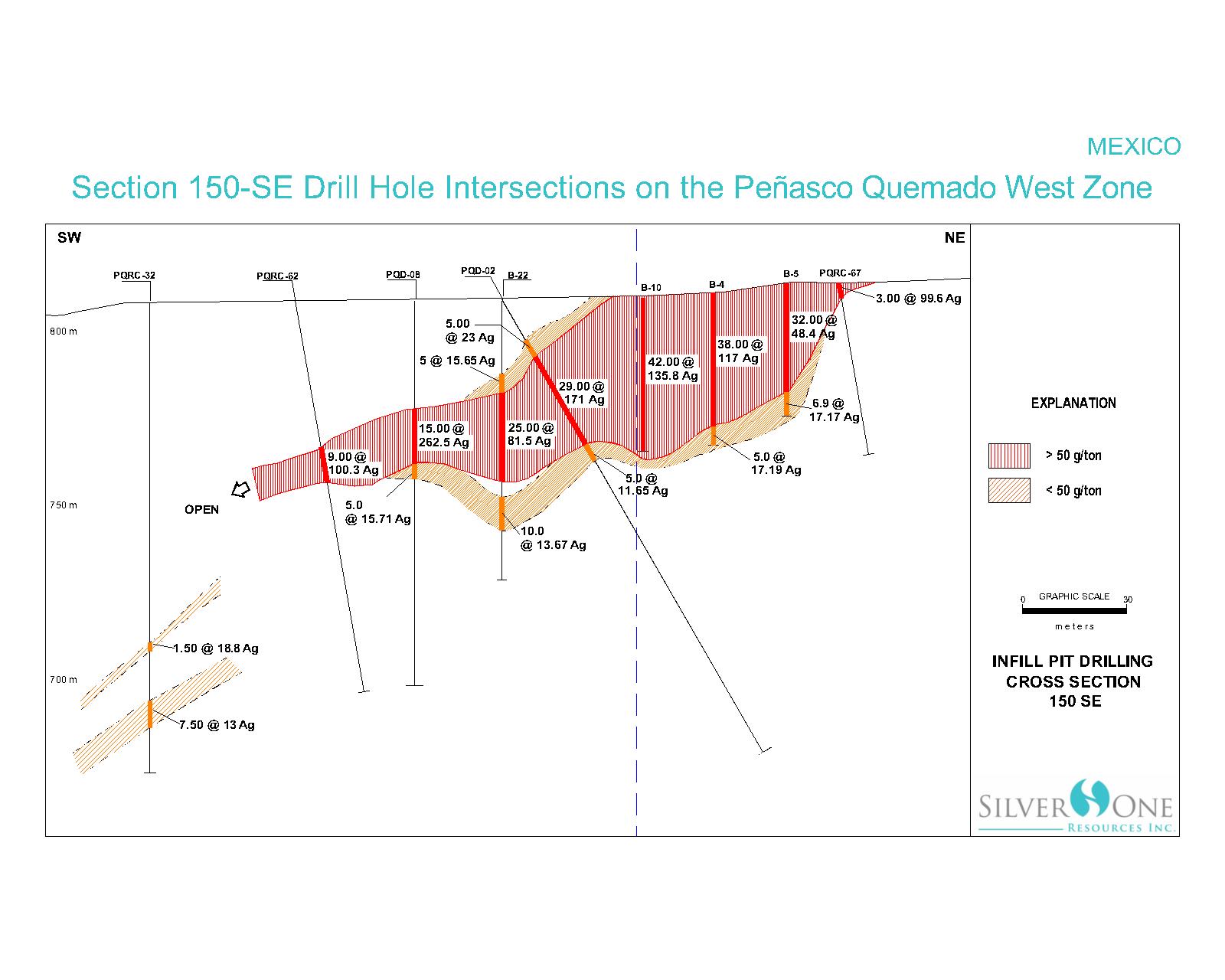
Maps
-
Technical Reports
Mar 24, 2017
Peñasco Quemado, Sonora, Mexico


* The technical content on this website has been reviewed and approved by Robert M. Cann, P. Geo, and a Qualified Person as defined by National Instrument 43-101.
© 2024 Silver One Resources Inc. All rights reserved.
View our legal notices. Website by Adnet
© 2024 Silver One Resources Inc. All rights reserved.
View our legal notices. Website by Adnet